Geotechnical Study Exemption Map
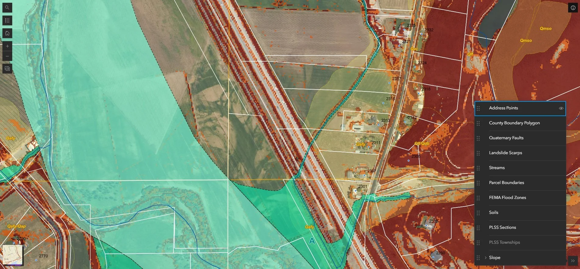
Geotechnical studies are expensive, and not every parcel needs one. We worked alongside a county planning department, county engineer, county surveyor, and a geotechnical engineer to identify the criteria that could legitimately exempt a property from that requirement — things like soil type, flood risk, slope, known landslide areas, and fault lines.
From there, we built an interactive map that classifies every parcel in the county by those criteria, complete with a parcel search, address points, and a print feature so residents can attach the output directly to their building application. The map was formally adopted into the county code and remains in active use today, saving residents the cost of unnecessary studies while giving the planning department a reliable, defensible tool to work with.